Tag Archives: Redevelopment

The Privateer’s House

On this very day in 1776, the Continental Congress authorized private vessels commissioned with “Letters of Marque and Reprisal” to “make captures of British Vessels and Cargoes” and Salem’s shipowners and shipmasters responded enthusiastically: 158 privateering vessels originated from Salem during the Revolution, capturing 458 prizes and the largest prize tonnage of any single American port. It seems appropriate to feature what once was the home of a particular (and particularly active) privateer today: a structure that long stood on Lynde Street downtown and is now in the process of being “transformed” into a much enlarged building in a Georgian-esque style, complete with a built-in garage. I don’t know how much is left of the James Barr House, actually, but a brief history of its most celebrated occupant and record of its evolution are below.

James Barr was born several years before his father, also named James, built the family homestead at 25 Lynde Street, but he spent most of his childhood and adulthood in the house and died in it in 1848, at age 93. His was a full and long life, on sea and on land. Fortunately we have a wonderful and accessible source: his grandson James Barr Curwen published Barr’s “Reminiscences,” including his Revolutionary War commissions, in the Historical Collections of the Essex Institute in 1890 (Volume 27). Barr spent the war in service: on the Black Snake as First Lieutenant in 1777 and as Captain of the Oliver Cromwell, the Rover, and the Montgomery thereafter. He took prizes and was taken prisoner: he spent several months onboard the infamous British prison ship Jersey in New York Harbor and was also transported by the British to Barbados: nevertheless he always seemed to be able to extricate himself and find another ship. Unfortunately his grandson includes more details about the terms of his commissions than his escapes. After the war, Barr became a merchant mariner in partnership with his brother John: their copper-bottomed ship Hope was apparently one of the speediest Salem ships to the East Indies. Mr. Curwen assesses his grandfather’s retirement as “quiet”: “in early days he was a staunch Federalist and later a Whig, but he never took a conspicuous part in politics. He lived a strictly honest and conscientious life and died respected by all who know him at the age of ninety-three years, four months, twenty-one days.” James Barr’s “Reminiscences” also include a portrait commissioned in Leghorn for East India Hall and a very rare photograph of the old captain in the year before his death.  Photographs of Revolutionary-war veterans have been the subject of several studies over the past few years and I’m not sure this particular one is well-known: what a record!

In another town, a famous privateer’s house might be preserved and celebrated: but that’s not the Salem way. The Barr house, built on the storied site of Salem’s first fort in 1759, left the family’s possession in the early twentieth century and its downtown location rendered it vulnerable to commercial and multi-residential use. Much of Salem’s downtown is under the jurisdiction of the Salem Redevelopment Authority (SRA) rather than the Salem Historical Commission: those identifying adjectives are apt. Here is the visual evolution of the house over more than a century: from Curwen ownership in the 1890s (captured in Frank Cousins photographs from the Phillips Library and Digital Commonwealth) to a MACRIS photograph from 2016, to the day it lost its gambrel roof last week, to this morning, and a rendering of its completed form encompassing however many condominiums were approved by the SRA.

And here’s the description from the Massachusetts Historical Commission’s 2016 MACRIS inventory by Neil Larson and Walter R. Wheeler: The Barr house is one of a diminishing number of mid-18th century vernacular wood frame dwellings in Salem. Although it has experienced minor alterations and significant additions over time, the original outline of the dwelling remains clearly readable; it retains its original form, feeling and materials, and continues to embody the distinctive characteristics of a mid-18th century side passage gambrel-roofed dwelling. 


From Space to Place

The City of Salem has purchased a large vacant lot at 289 Derby Street which has long served as an industrial and commercial site given its location on the South River that opens up into Salem Harbor. A few weeks ago a public “placemaking” process commenced, under the auspices of the City, CBA Landscape Architects, Salem Public Space Project and Creative Salem : engaging events are happening every Wednesday night until June 21st and people can also write their ideas on an on-site chalkboard whenever they happen to be passing by. After all the unimaginative private projects that have come our way over the last few years this is a welcome opportunity for the public to imagine and impact a key Salem development, and transform an empty space into an inviting place.

Placemaking Lot

Placemaking 1897 
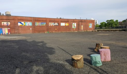
The lot today and on the 1897 Salem Atlas, marked by the old lightbulb. It was R.C. Manning & Company’s coal and lumber yard then, and it served in a similar capacity well before and after. Below: the process of placemaking.

Placemaking board

Placemaking Boards

Placemaking Events

I’m feeling left out as I have my summer research seminar class every Wednesday night so I’m missing all these events! I guess I’ll just have to put my idea out here. It’s not really original, it’s a bit silly, and it probably doesn’t suit the lot, but here it is: a Monopoly Park. To pay tribute to one of Salem’s most illustrious businesses and products, I’d like to see this lot transformed into some semblance of the iconic board game. This is how I envision it: real estate lots around the perimeter, perhaps just painted concrete (maybe some benches that somehow reference the look of Monopoly houses and hotels), inside a courtyard of grass, with tables that look like Community Chest and Chance cards and topiaries that look like Monopoly tokens! Can’t you picture it? I really can (with a little help from some of the pins below), and I think it would be pretty low maintenance with the exception of the topiaries. Topiaries can be troublesome.

Monopoly in the Park in San Jose, California: Why San Jose and not Salem? Ours could be better: more creative, more green, more place-appropriate, more of a Monopoly Park than Monopoly in the Park.

Monopoly in the ParkMonopoly in the Park in San Jose (You can see more images at Anna Fox’s Flickr album); there have also been temporary life-sized Monopoly boards built in other places, including Atlantic City, of course.

Monopoly in the Streets of Chicago: the creation of an anonymous artist referred to as Bored. Those plywood cards could be enlarged for our tables! Dice for stools.

bored-8

bored-3 Street Monopoly by Bored, via Colossal.

I’m not sure how to integrate the Monopoly houses and hotels into the design (benches? public bathrooms? snack bar?) but we could have Monopoly murals on the side facade of the adjoining brick building, just like there are now (this would require Hasbro’s permission–and perhaps we could get some underwriting too?). I’m seeing green, so it would be great if the tokens could be topiaries but I guess they could be sculptures—which would enhance the park’s attraction all year long.

Monopoly gameMonopoly Mural

Monopoly Big Cat

Monopoly Token CollageCanadian artist An Te Liu’s Monopoly House in suburban Toronto; Tom Taylor’s mural for Hasbro; a 6-foot tall promotional replica of the new cat token, carted around London in 2013; the displaced iron token (my favorite!!!) and the hat from “Your Move“, (Daniel Martinez, Renee Petropoulis & Roger White), a public art project commissioned by the City of Philadelphia.

So that’s my pitch: a Monopoly Park/ Parker Brothers Place. The other idea that keeps popping into my head is move Samantha to Derby Street, a far more appropriate place than Town House Square. But every time I criticize that stupid statue I get into trouble, so I’m just going to leave that there.


More Harmonious Hamptons

There are no flourishes or deep dives in today’s post; I’m simply offering up some alternatives to the new Hampton Inn that will open in a dreadful building to be built at the southern end of Washington Street in Salem, in a thoroughly commercial zone. There’s no preservation issue here–this building will replace a rather dilapidated one-story commercial strip built in the twentieth century–but there are “suitability” questions, which the general public never seems to have the opportunity to weigh in on: of size, scale, use, design. This is the latest in a series of big boxy buildings built in downtown Salem that are transforming its architectural character in a rather alarming manner.

Hampton Inn Salem MA

Dodge Street Hotel Salem News 2014

Rendering and model of the recently-approved  five-story, 178,000-square- foot, $50 million-dollar building-complex to be built on an entire city block between Washington and Dodge Streets and Dodge Street Court in Salem, Salem News.

The Hampton Inn will comprise only part of this monstrous complex, which is being developed by RCG, a real estate development company headquartered in Somerville, MA which has an ever-increasing profile in Salem. The generically ghastly Tavern in the Square building (which everyone refers to as the TITS building), located just a few yards down Washington Street from the Hampton Inn site, is proudly posted on their corporate website, and indeed the first design for the latter looked very much like the former. Apparently it was “improved” in the planning and design review process, so it is “better” now, both “better” than what was there before and better than the original design. The potential economic benefits of this project are considerable, so its design is a secondary (tertiary? inconsequential?) consideration: it is “better” so it will be built. As I indicated above, the Hampton Inn is only one component of this project, but that is the component which can offer some comparisons, so I went searching for some. There’s been some criticism of a chain hotel coming to Salem, but I don’t share that view: I think we are losing out to the chains proximate to Route 128 if we don’t have something comparable in our city. But we don’t need to accept a standardized design: it seems clear to me that Hilton Worldwide will conform to local settings for their Hampton Inns (actually now I think they are called Hampton by Hilton) brand, but apparently setting is not a consideration in Salem.

A subjectively-selected showcase of urban Hampton Inns: first new construction, then adaptive reuse, which is not an option for the Salem site.

hampton-inn-suites-savannah

Hampton Inn Savannah Savannah

Hampton Inn Alex VA Alexandria, Virginia

hampton-inn-new-orleans-st-charles-ave-garden-district-hotel-front New Orleans/Garden District

Hampton Inn Baltimore Baltimore

Adaptive reuse:

Hampton Inn Providence downtown Providence

Hampton_by_Hilton_Kansas_City_Downtown_Financial_District_Exterior_HR Kansas City

Hampton Inn Ogden Ogden, Utah

Hampton Inn Cincinnatti Cincinnati


Losing our Way?

One of the latest looming commercial developments in Salem is a proposal for a new showroom facility by the F.W. Webb Company, a large distributor of plumbing and HVAC parts, on an abandoned lot adjacent to its large brick building on Bridge Street. The lot was long occupied by the Universal Steel and Trading Company, which stored and processed scrap metal on the site, creating a contaminated cauldron from which they simply walked away, leaving the City to clean up the mess. Once the site was cleaned up–a process that took several years–the City put the parcel up for sale, and F.W. Webb was the only bidder. The public process by which the City divests itself of the site and the Webb proposal is reviewed by various city boards commenced last week, and consequently both the big picture and the little details are starting to emerge. Regarding the former, the jury’s still out for me–of course the proposed new building appears blandly “modern” and appears to have no connection to the existing Webb building–but this section of Bridge Street is not distinguished by structures of great architectural integrity. Where the terraced gardens of Federal Street houses once sloped down to the North River used car lots have more recently and characteristically occupied a filled-in Bridge Street, so you can argue that anything is an improvement. There are two “details” that do concern me at this point in the process, however: 1) the not-so-veiled threat inherent in the F.W. Webb proposal documents: this new building will allow us to remain in Salem and; 2) the loss of venerable public “way”called Beckford Way. This public path once accessed the riverfront but is now a trail to nowhere; nevertheless, it is still public property and will cease to be if the Webb proposal is approved.

Path 009

Webb Building

Path 001

Beckford Way

Bridge Street 2016 MA Boating and Fishing Access

NOW: The current Webb building on Bridge Street and the adjacent lot, now cleaned and paved, on which the company wants to build a new showroom building; rendering of the proposed new building and Beckford Way alongside the lot. A current map of Salem, with no Beckford Way.

I looked into the history of Salem’s public ways a bit, primarily by examining maps of the city in 1820, 1851, 1903 and 1916 in the Norman B. Leventhal collection at the Boston Public Library. It was an interesting exercise, through which you could clearly see the disappearance and/or transformation of myriad ways, courts, and even streets by projects that were both public and private. The nineteenth century privileged the train while the twentieth century was all about the car; the pedestrian lacked advocacy in both centuries. Sewall Street, once lined with houses, became a parking lot for the YMCA and adjacent developments; Liberty Street was absorbed by the Peabody Essex Museum just a decade ago. Now all of Salem’s “ways” exist only in condominium developments built out on Highland Avenue: they’re not even really part of the city.

Salem 1820 BPL

Bridge Street Before LC HABS

THEN: Jonathan Saunders map of Salem, 1820, clearly indicating Beckford Street’s access to the North River, Boston Public Library Leventhal Map Center; a map of the terraced gardens of Federal Street (a bit further west from the Webb property) before the River was filled in for the railroad and Bridge Street extension, HABS, Library of Congress.


%d bloggers like this: