
After last year’s full immersion into Haunted Happenings, Salem’s month-long celebration of its apparently fortunate association with the tragic Witch Trials of 1692, I’ve decided that a better course of action for me this year is to get out of town. I try to engage in the festivities every three years or so, but last year was just too much: too much craven exploitation, too much tackiness, too much trash. Last year nearly broke me: if my husband had had a similar reaction and intent, we would have sold the house and moved to Ipswich. I don’t want to move, so this October I will simply escape Salem whenever I can–or hunker down in the house (I’ve brought in supplies). I’m sure my family, friends and students will appreciate this decision, as I’ll be a much nicer person to be around, but this is a declaration for my faithful readers: my blog’s title will be a misnomer for most of this month, although I might be able to sneak in a few midweek walks.
October is also a busy academic month, so I’ll have to take quick regional road trips whenever I can. The other day, I meandered around the South Shore, a world apart from the North as any greater Bostonian knows. I got off the highway in Dedham, which has a wonderful historic downtown, drove on small roads all the way down to Plymouth, and then back up north via Route 3A on the coast. I took tons of photographs, but it was a rainy, cloudy day so most of them didn’t really “pop” (especially as I seem to have a predilection for two-story square white colonial houses–you don’t need to see a multitude of those!) Now, before I get multiple protests from local readers, let me say that in the greater Boston area, many people do not consider Dedham to be part of the South Shore, as it is decidedly not on the coast and too far west: as you can see, it is not on this “North Shore vs. South Shore” map from Boston Magazine. But I’ve never known how to classify Dedham geographically so I am including it here—northwestern towns like Burlington (??????) are regularly included in the North Shore, so it seems only fair to include southwestern towns like Dedham in the South.
 Map by John S. Dykes, Boston Magazine
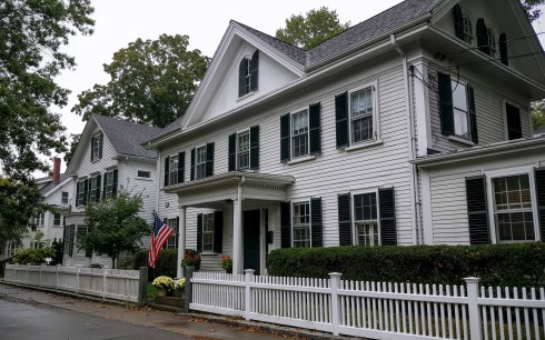
Downtown Dedham: even though it’s about half the size and much less urban, Dedham is kind of like Salem in that it’s a county seat and a “mother of towns”—an early settlement from which all the surrounding towns later separated. Dedham is also difficult to get into because of traffic and a confusing intersection of major arteries–but well worth the effort.


……all in the immediate downtown with the exception of the amazing first-period Fairbanks House. Then it was down to Plymouth via routes 138 and 106 with a pitstop in Plympton.
Plympton and Plymouth:


SHEEP in relatively rural Plympton and this rather stately old brown house….on to Plymouth which is large geographically and always somewhat less historical than you expect it to be–however there are some great old houses there, and of course the Mayflower II. I don’t think we need a picture of the rock, and I’ll leave Plimoth Plantation for another post.


Then back up north via Route 3A, through Duxbury, probably the most beautiful town in Massachusetts, which one local radio host used to refer to as “Deluxbury”. Very pristine–and no sidewalks! Then on to Marshfield–where my camera promptly ran out of power. I will return–I have an entire month of daytrips ahead of me!


There are so many beautiful houses in Duxbury it was difficult to choose , so I just limited myself to one–the very Salem-like Nathaniel Winsor House, headquarters of the Duxbury Rural and Historical Society. Shingles everywhere on the South Shore, less common on the North. LOVED Marshfield Hills, especially these last two houses.


